The following image looks innocuous, but it has the potential to develop into a major Atlantic tropical system within the next week or so.
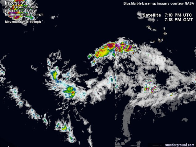
The models, as of this afternoon, have the storm tracking near Florida and/or into The Gulf of Mexico. However, this is still many days away and the forecast can change.

The GFS model is especially bullish, as seen in the video below.
