Texas Flash Flood Tragedy

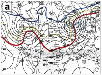
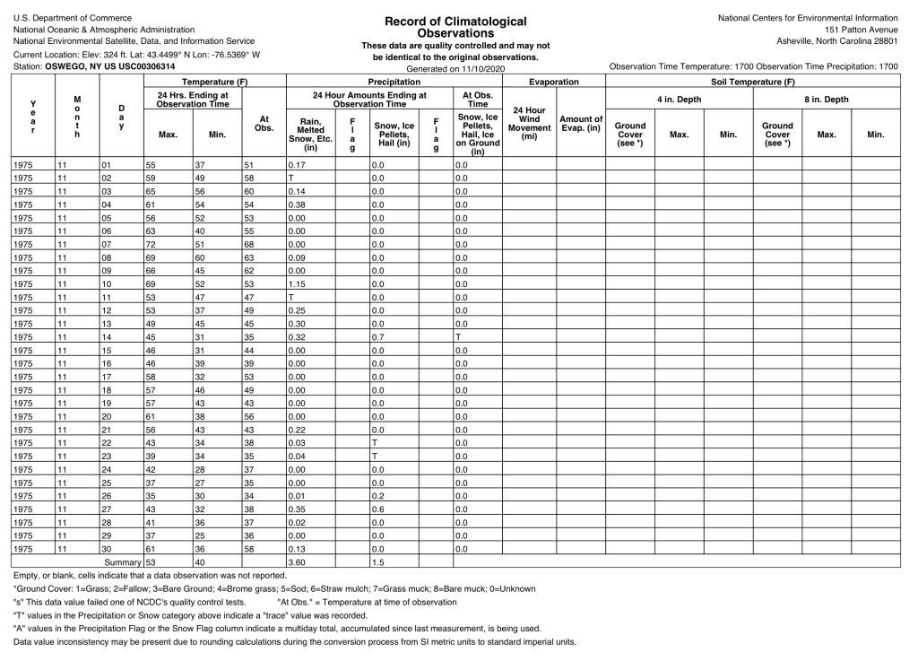
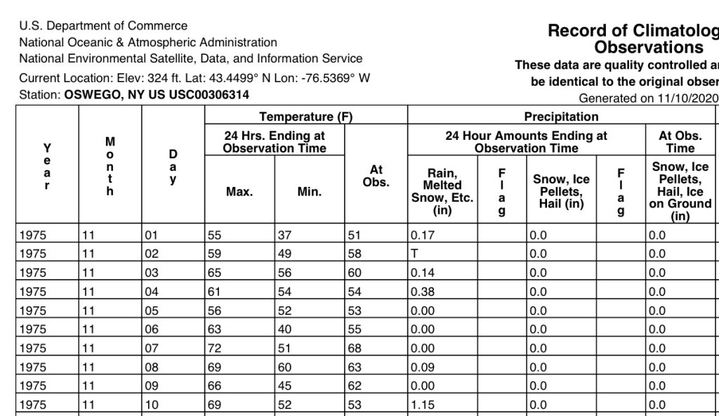
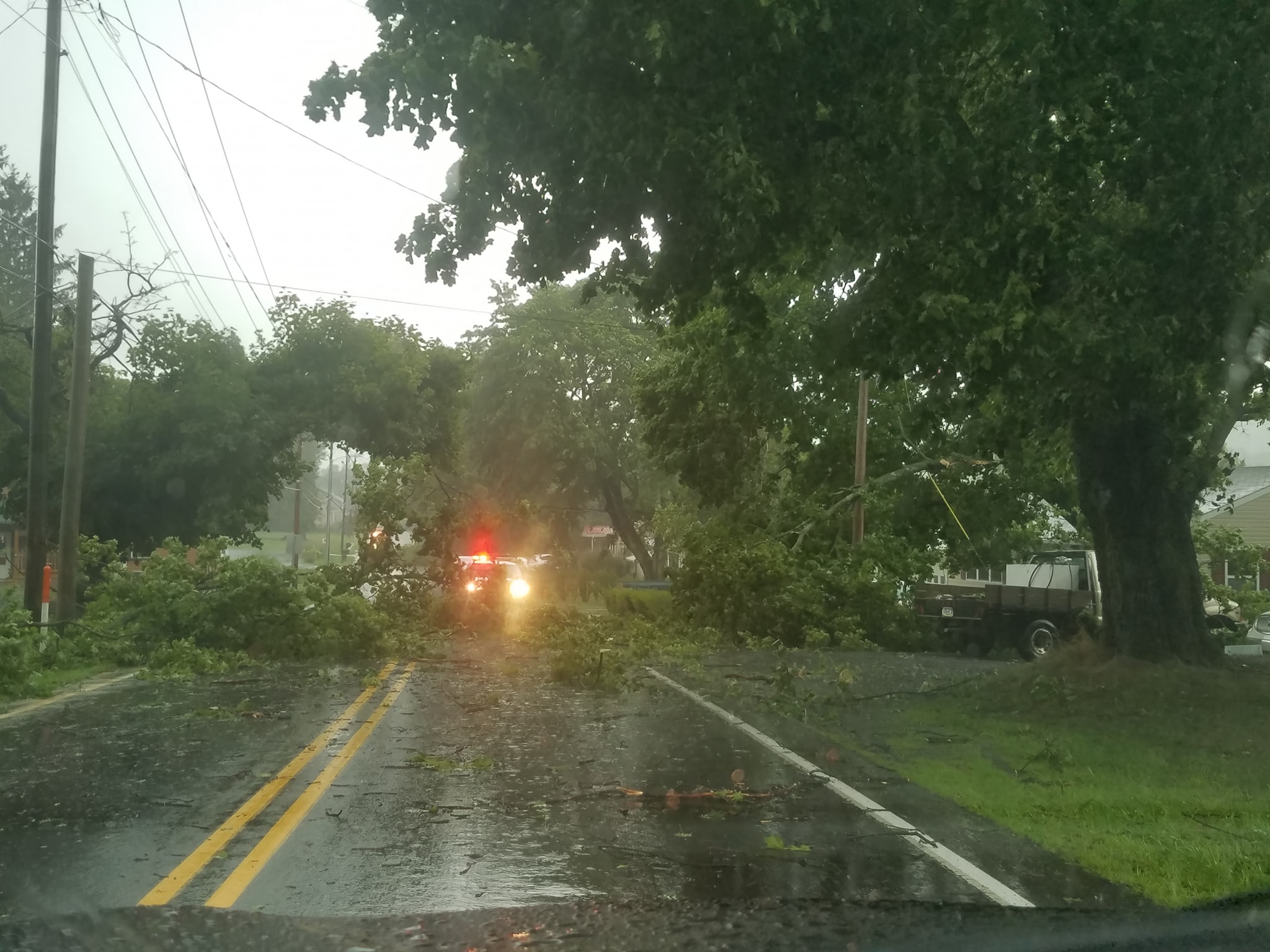
In spite of what some irresponsible newscasters are reporting, along with some political figures, the tragedy of the flash floods in Texas was not due to budget cuts, nor was it due to lack of staffing at The Weather Forecast Office (WFO) for Austin/San Antonio. The cuts were not in place and there were more people on duty than normal at the WFO during the event.

The first notification from the WFO was issued 12 hours in advance of the first warnings. Timely notifications also followed. The flood watch that was issued at 1:18 PM CDT on July 3, 2025, appears below:

038 
WGUS64 KEWX 031818
FFAEWX

URGENT - IMMEDIATE BROADCAST REQUESTED
Flood Watch
National Weather Service Austin/San Antonio TX
118 PM CDT Thu Jul 3 2025

TXZ183>187-202>204-041200-
/O.NEW.KEWX.FA.A.0003.250703T1818Z-250704T1200Z/
/00000.0.ER.000000T0000Z.000000T0000Z.000000T0000Z.OO/
Val Verde-Edwards-Real-Kerr-Bandera-Kinney-Uvalde-Medina-
Including the cities of Del Rio, Leakey, Brackettville,
Kerrville, Bandera, Hondo, Uvalde, and Rocksprings
118 PM CDT Thu Jul 3 2025

...FLOOD WATCH IN EFFECT THROUGH FRIDAY MORNING...

* WHAT...Locally heavy rainfall could cause flash flooding across portions of South Central Texas. Rainfall amounts of 1 to 3 inches with isolated amounts of 5 to 7 inches are possible.

* WHERE...A portion of south central Texas, including the following counties, Bandera, Edwards, Kerr, Kinney, Medina, Real, Uvalde and Val Verde.

* WHEN...Through Friday morning.

* IMPACTS...Excessive runoff may result in flooding of rivers, creeks, streams, and other low-lying and flood-prone locations. Creeks and streams may rise out of their banks.

* ADDITIONAL DETAILS...
- A moist tropical airmass combined with a slow moving storm system will bring rounds of scattered to widespread showers and storms with heavy rain rates possible.
- http://www.weather.gov/safety/flood

PRECAUTIONARY/PREPAREDNESS ACTIONS...

You should monitor later forecasts and be alert for possible Flood Warnings. Those living in areas prone to flooding should be prepared to take action should flooding develop.

&&

$$

TRAN

March 2025 Microburst and Mast Repair

On Sunday, March 16, 2025, at 2:30 PM, a line of severe thunderstorms passed through our area. A high wind of 46 mph ripped out the guy lines of my weather mast and bent it over by 45 degrees. The State College NWS Office (CTP) reported microbursts in the area so it is possible that the wind speeds were higher. More information about the storm:
https://www.weather.gov/ctp/2025-Feb-15to17-Mixed-Precip-High-Winds

Damaged Mast
High Wind Speed Before Instrument Failure

I removed the damaged 16 gauge 10’ mast section (pictured below).

I installed two new 5′ mast sections and a new wind sensor package. The wind direction sensor had been behaving erroneously several weeks before the storm. The mast was hoisted into place and secured to the fence post with new hose clamps. The wind sensor cable was plugged into the weather station transmitter and secured with cable ties. The guy lines were then staked to the ground.

Repaired weather mast.

Edmund Fitzgerald Storm

Today is the 45th anniversary of the wreck of The Edmund Fitzgerald. A colleague of mine, and former roommate at SUNY-Oswego, asked if the storm that sank the ship, also affected Oswego, NY, on that fateful day (November 10, 1975). One of the advantages of being retired is having the time to do such research.

I found the following weather maps from an article in The May 2006 issue of The Bulletin of The American Meteorological Society (BAMS): Reexamination of the 9–10 November 1975 “Edmund Fitzgerald” Storm Using Today’s Technology.

Synoptic Charts for November 10, 1975, Oswego, NY marked by the green crosses.
850 mb Analysis for November 10, 1975 1200 UTC. -5 C, 0 C, 5 C isotherms marked by the blue, yellow and red lines, respectively.

I also obtained the weather records from November 1975 for Oswego, NY from The National Centers for Environmental Information.

Weather data for Oswego, NY,November 1975.
Enlarged Image of Oswego Data for November 1975

The high of 69 F and low of 52 F, quite warm for that time of year, confirms that Oswego, was in the warm sector of the storm system as a warm front passed through the area. The surface and 850 mb analysis shows the winds in Oswego were from the south and not off Lake Ontario. Exact wind speeds can not be ascertained from the charts, but judging from the tight isobars and geopotential isopleths, it was probably brisk and accounts for the warm air advection. Also, 1.15 inches of rain fell during the day. A cold front moved through later that evening.

So The Edmund Fitzgerald Storm did affect SUNY-Oswego on Monday, November 10, 1975.

Thunderstorm Strikes Stormstown

A severe thunderstorm occurred at approximately 4:15 PM EST in Stormstown, PA. Two small trees blocked part of  PA 550, and a large tree fell across the highway, downing utility lines, near Brothers Pizza.

damage

Photo Courtesy Of Tom Majewski

The highway, further north, was also blocked by Sawmill Road. More wind damage occurred in Port Matilda and in State College on N. Atherton Street, Blue Course Drive, W. Beaver Avenue, and Westerly Parkway.

The official Local Storm Report (LSRCTP):

0413 PM TSTM WND DMG STORMSTOWN 40.79N 78.01W
08/18/2019 CENTRE PA 911 CALL CENTER

TREE AND WIRES DOWN

Video of hail in Stormstown.

There was also pea-sized hail and heavy rain as high as 10 in/hr. The maximum wind speed was 36 mph, the temperature dropped 22 F, and the total rainfall was 1.35 inches.

Tstorm

The damage at my home was limited to a badly damaged flagpole. However, the wind had caused a heavy patio chair to be sent down the stairs from my deck to the landing.

IMG_0942