For an anniversary gift I ordered and received the following framed map from my wife.
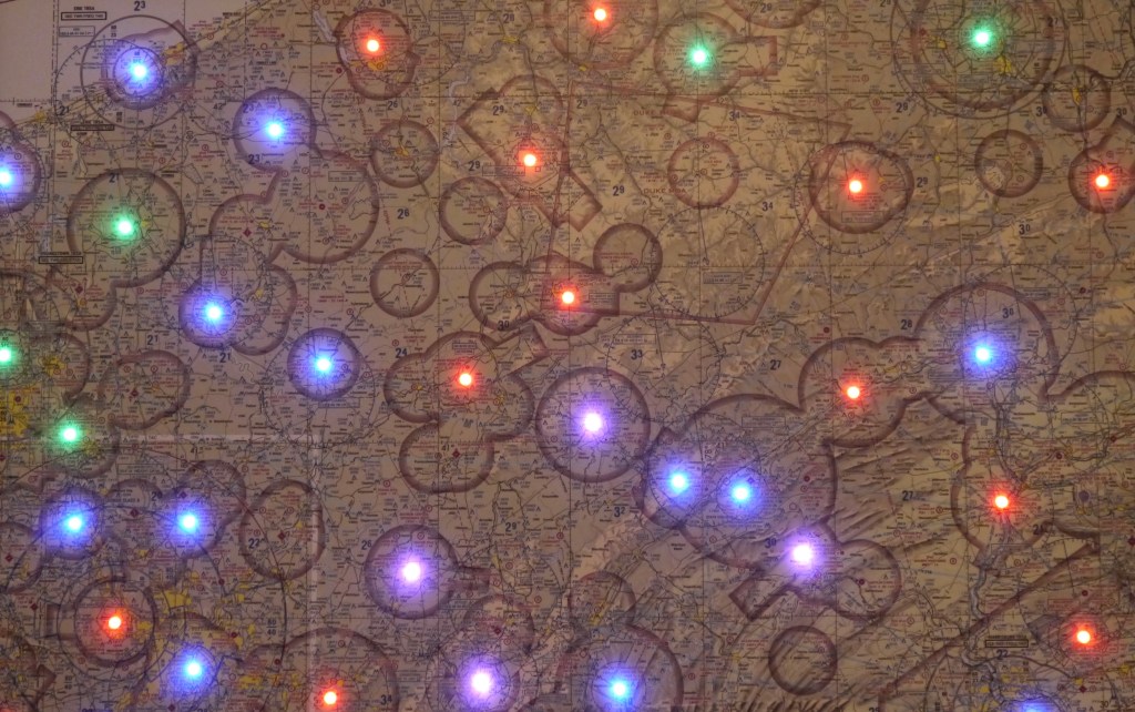
It is an aviation map of western Pennsylvania with a multicolor LED placed at each airport location that issues METARs (METeorological Terminal Aviation routine weather Report). The color of each LED indicates the ceiling and visibility.
Color Code
- VFR (>3000ft ceilings and >5nm visibility) = Green
- MFR (1000-3000ft ceilings and 3-5nm visibility) = Blue
- IFR (500-1000ft ceilings and 1-3nm visibility) = Red
- LIFR (<500ft ceilings or <1nm visibility) = Purple
- Smoke = Gray
- METAR older than 6 hours = Blank
METAR data are processed by a Raspberry Pi, a low-cost single-board computer, which is fastened behind the map. Data are received via a WiFi connection every five minutes. The brightness of the LEDs also changes for day/night conditions.
