Tropical Storm Matthew formed today. It is forecast to become a hurricane this Friday.
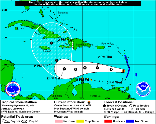
What is unusual is that the forecast track has the system making a hard right turn to the north sometime this weekend. Most of the models are in agreement to that forecast.
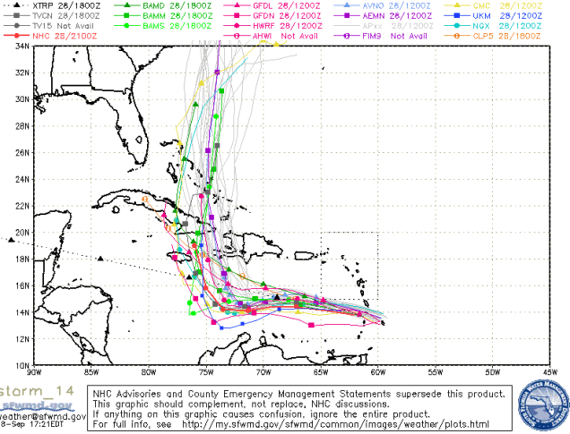
However, the two main models, GFS and ECMWF, disagree on where it will track a week from now. An earlier run of the GFS had it going up Chesapeake Bay next Thursday. The ECMWF has it moving slower with a possible landfall in southern Florida, so this should be watched carefully in the coming days.
