August 2022 Weather Summary

August was 0.6 deg F above normal for temperature. The high for the month was 89.7 deg. F recorded on August 8. The low for the month was 44.9 deg F, recorded on August 13. There were 0 days at or above 90 deg F. There were 36 heating degree days and 222 cooling degree days.

August was a below-normal month for precipitation with 3.20 inches of rainfall recorded, which was 0.96 inches below normal. The maximum rainfall in a single day was 0.82 inches recorded on August 21. There were 13 days of rain >.01 in, 8 >.10 in, and 0 >1 in.

High wind speed of 26 mph on August 8.

August 2022 Data

July 2022 Weather Summary

July was 0.8 deg F above normal for temperature. The high for the month was 91.2 deg. F recorded on July 23. The low for the month was 50.0 deg F, recorded on July 4. There were 3 days day at or above 90 deg F. There were 27 heating degree days and 275 cooling degree days.

July was a below-normal month for precipitation with 2.02 inches of rainfall recorded, which was 1.77 inches below normal. The maximum rainfall in a single day was 0.46 inches recorded on July 7. There were 8 days of rain >.01 in, 6 >.10 in, and 0 >1 in.

High wind speed of 26 mph on July 23.

July 2022 Data

June 2022 Weather Summary

June was 0.1 deg F above normal for temperature. The high for the month was 93 deg. F recorded on June 22. The low for the month was 47 deg F, recorded on June 5. There were 74 heating degree days and 171 cooling degree days.

June was a below normal month for precipitation with 3.40 inches of rainfall recorded, which was 0.69 inches below normal. The maximum rainfall in a single day was 1.13 inches recorded on June 22. There were 12 days of rain >.01 in, 7 >.10 in and 1 >1 in.

High wind speed of 33 mph on June 17.

June 2022 Data

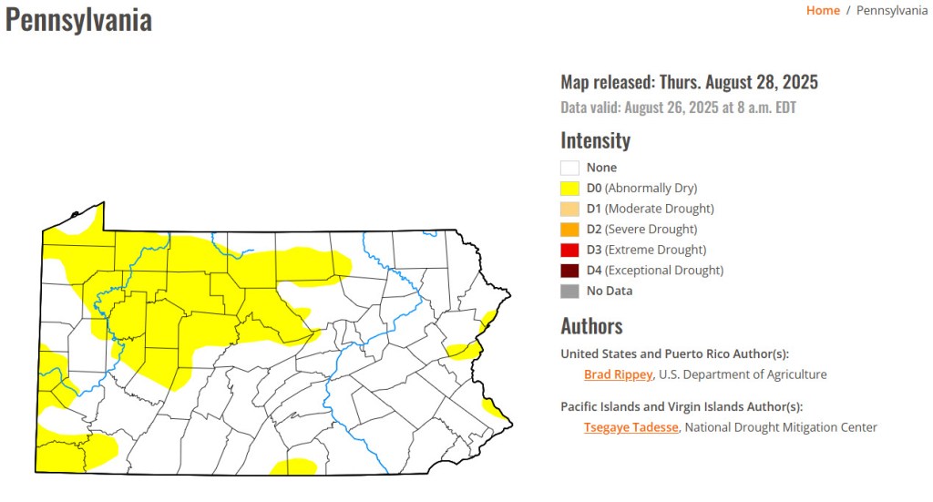
Here is the latest drought summary for Pennsylvania:

Summary of Spring 2022

Meteorological Spring is officially over. Here is a brief summary of March 1 – May 31, 2022 in Stormstown, PA:

Number of Days Max T <= 32 F: 2
Number of Days Min T <= 32 F: 23
Max T: 89.2 F – May 31, 2022
Min T: 12.5 F – March 4, 2022

Mar Dep from Normal: 4.1 F
Apr Dep from Normal: -1.7 F
May Dep from Normal: 1.8 F

Heating Degree Days: 1465
Cooling Degree Days: 99

Mar Precip: 3.25″, 0.13″ below normal
Apr Precip: 2.84″, 0.67″ below normal
May Precip: 5.22″, 1.58″ above normal

May 2022 Weather Summery

May was a near normal month for temperature. 1.3 deg F below normal for temperature. The high for the month was 87.7 F, recorded on May 21. The low for the month was 32.4 deg F, recorded on May 13. There were 0 days at or below 32 F. There were 297 heating degree days and 74 cooling degree days.

May was an above normal month for precipitation with 3.67 inches of rainfall recorded, which was 0.44 inches above normal. The maximum rainfall in a single day was 1.15 inches recorded on May 9. There were 10 days of rain >.01 in, 9 >.10 in and 1 > 1 in.

The high wind speed for the month was 33 mph on May 26.

May 2022 Data

April 2022 Weather Summary

April was 1.7 F below normal for temperature. The high for the month was 83.2 F, recorded on April 24. The low for the month was 26.8 F, recorded on April 11. There were 7 days at or below 32 F. There were 535 heating degree days and 14 cooling degrees days.

April was a below-normal month for precipitation with 2.84 inches of rainfall recorded, which was 0.67 inches below normal. The maximum rainfall in a single day was 0.65 inches recorded on April 7. There were 14 days of rain >.01 in, 6 >.10 in and 0 > 1 in.

It snowed about 5 inches on April 18.

High wind speed of 43 mph on April 16.

April 2022 Data

March 2022 Weather Summary

March was 4.1 deg F above normal for temperature. The high for the month was 71.5 deg. F, recorded on March 18. The low for the month was 12.5 deg F, recorded on March 4. There were 2 days where the maximum temperature was at or below 32 F, and there were 16 days where the minimum temperature was at or below 32 F. There were 741 heating degree days and 3 cooling degree days.

March was a near-normal month for precipitation with 3.25 inches of rainfall recorded, which was 0.13 inches below normal. The maximum rainfall in a single day was 1.25 inches recorded on March 31. There were 13 days of rain >.01 in, 9 >.10 in and 1 > 1 in. There was also 11.1 inches of snow. There was pea-sized hail observed during a severe thunderstorm on March 31.

High wind speed of 42 mph on March 7.

March 2022 Data

Summary of Winter 2021-2022

Meteorological Winter is officially over. Here is a brief summary of December 1, 2021-February 28, 2022 in Stormstown, PA:

Number of Days Max T <= 32 F: 24  

Number of Days Min T <= 32 F: 72 

Number of Days Min T <= 0 F: 2  

Max T: 65.9 F – December 16, 2021  

Min T: -6.2 F – January 1, 2022

Dec Dep from Normal: 6.5 F  

Jan Dep from Normal: -2.9 F  

Feb Dep from Normal: 1.7 F  

Heating Degree Days: 3077  

Cooling Degree Days: 0  

Dec Precip: 2.69″, -0.49″ below normal  

Jan Precip: 1.29″, -1.63″ below normal  

Feb Precip: 4.34″, 1.88″ above normal  

February 2022 Weather Summary

Stormstown, PA – 02/21/2022

February was 1.7 deg F above normal for temperature. The high for the month was 61.8 deg. F, recorded on February 21. The low for the month was 5.7 deg F, recorded on February 15. There were 6 days when the maximum was at or below 32 F and 25 days when the minimum temperature was at or below 32 F. There were 958 heating degree days and 0 cooling degree days.

February was an above-normal month for precipitation with 4.34 inches of rainfall recorded, which was 1.88 inches above normal. The maximum rainfall in a single day was 1.63 inches recorded on February 3. There were 13 days of rain >.01 in, 8 >.10 in and 2 > 1 in.

There were 3.4 inches of snow for the month, with a maximum daily total of 1.7 inches on February 25. The 3-day total recorded on February 1-3 was 14.9 inches.

High wind speed of 40 mph on February 19.

February 2022 Data

The most significant event this month was the snow squall that passed through our area on February 20. There were whiteout conditions for a brief time.

January 2022 Weather Summary

January was 3.8 deg F below normal for temperature. The high for the month was 53.8 deg. F, recorded on January 1. The low for the month was -6.1 deg F, recorded on January 27. There were 18 days when the maximum was at or below 32 F, 30 days when the minimum temperature was at or below 32 F, and 2 days when the minimum temperature was at or below 0 F. There were 1261 heating degree days and 0 cooling degree days.

January was a below-normal month for precipitation with 1.29 inches of liquid precipitation recorded, which was 1.82 inches below normal. The maximum liquid precipitation in a single day was 0.37 inches recorded on January 1. There were 9 days of rain >.01 in, 4 >.10 in and 0 > 1 in.

There were 13.8 inches of snow for the month, with a maximum daily total of 5.1 inches on January 16.

High wind speed of 38 mph on January 17.

January 2022 Data