July was 2.3 F above normal for temperature. The high for the month was 93.7 deg. F recorded on July 30. The low for the month was 52.2 deg F, recorded on July 22. There were 6 days at or above 90 deg F. There were 15 heating degree days and 311 cooling degree days.
July was an above-normal month for precipitation, with 5.30 inches of rainfall recorded, which was 1.51 inches above normal. The maximum rainfall in a single day was 1.79 inches recorded on July 26. There were 9 days of rain >.01 in, 9 >.10 in, and 1 >1 in.
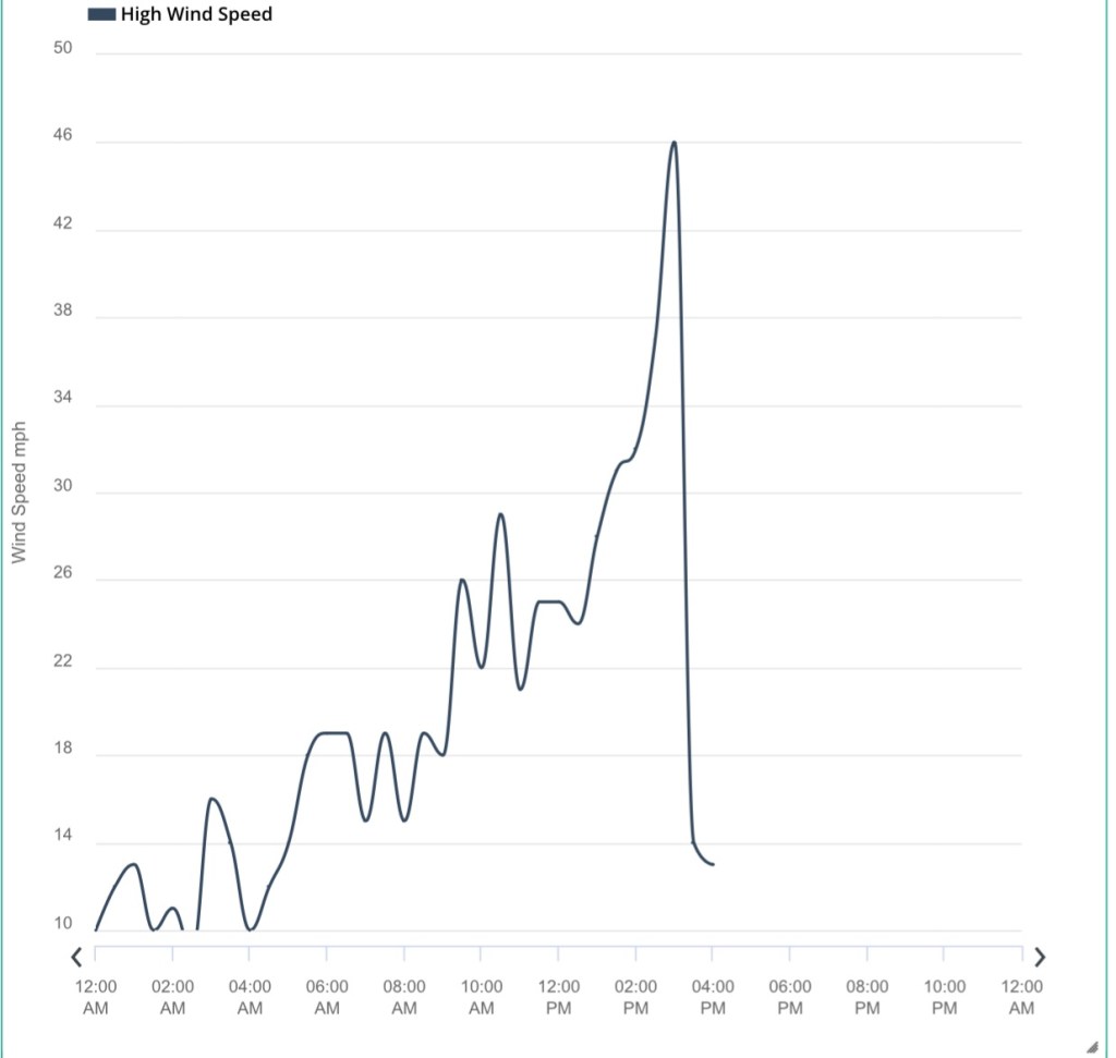
High wind speed of 25 mph on July 17.