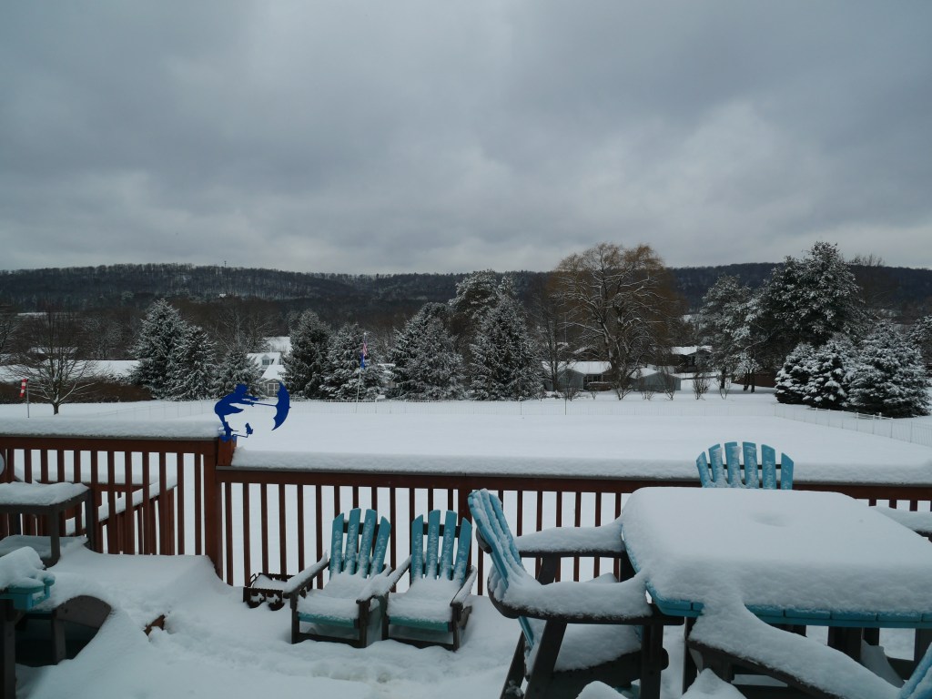
April was 2.4 F above normal for temperature. The high for the month was 85.0 F, recorded on April 29. The low for the month was 19.4 F, recorded on April 9. There were 5 days at or below 32 F. There were 434 heating degree days and 37 cooling degree days.
April was an above-normal month for precipitation with 4.08 inches of rainfall recorded, which was 0.57 inches above normal. The maximum rainfall in a single day was 0.84 inches recorded on April 5. There were 15 days of rain >.01 in, 10 >.10 in, and 0 > 1 in.
There was a trace of snow in April.
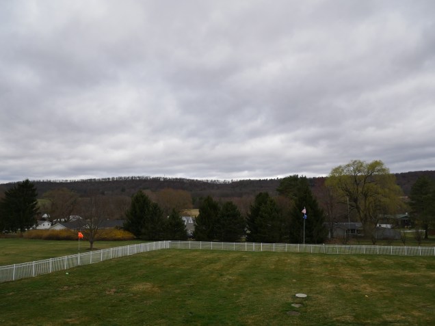
High wind speed of 49 mph on April 29.
A severe thunderstorm occurred on April 29, critically damaging trees, utility poles, and power lines. Power was out from April 29 at 6:43 PM until May 3 at 2:21 AM. No data was lost for April, but a few hours on May 2-3 were lost due to battery failure of the data logger.
March was 6.5 deg F above normal for temperature. The high for the month was 74.8 deg. F, recorded on March 30. The low for the month was 14.1 deg F, recorded on March 2. There was 1 day where the maximum temperature was at or below 32 F, and there were 17 days where the minimum temperature was at or below 32 F. There were 667 heating degree days and 6 cooling degree days.
March was a below-normal month for precipitation with 2.21 inches of rainfall recorded, 1.17 inches below normal. The maximum rainfall in a single day was 1.38 inches recorded on March 5. There were 6 days of rain >.01 in, 3 >.10 in, and 1 > 1 in. There was 0.3″ of snow accumulation.
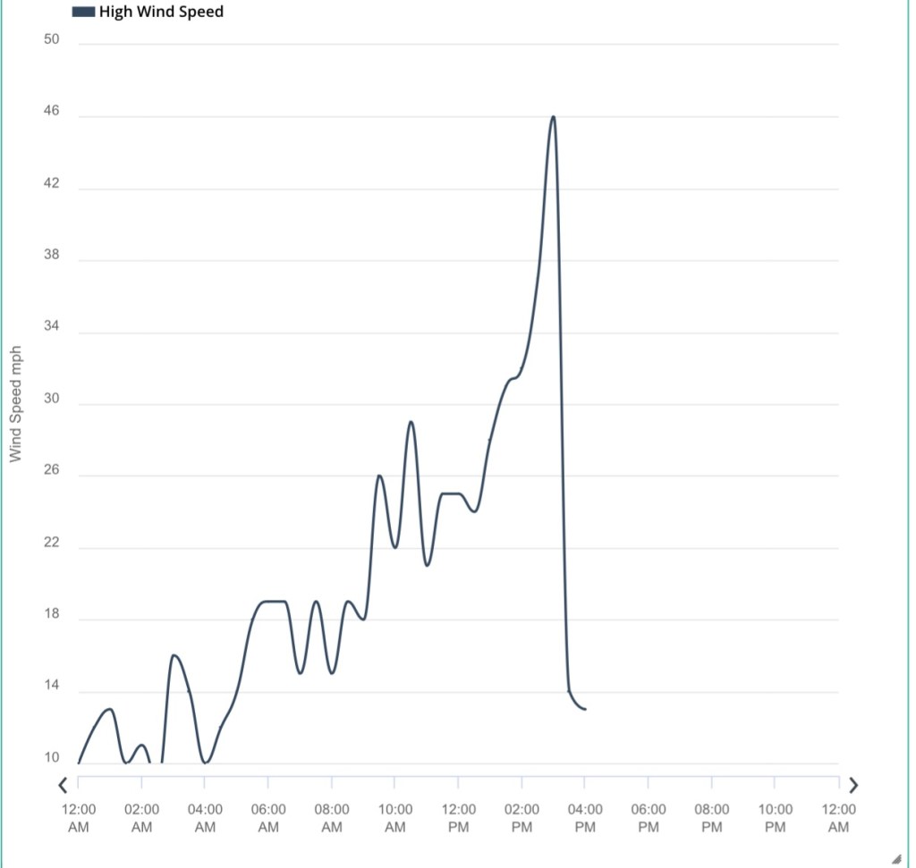
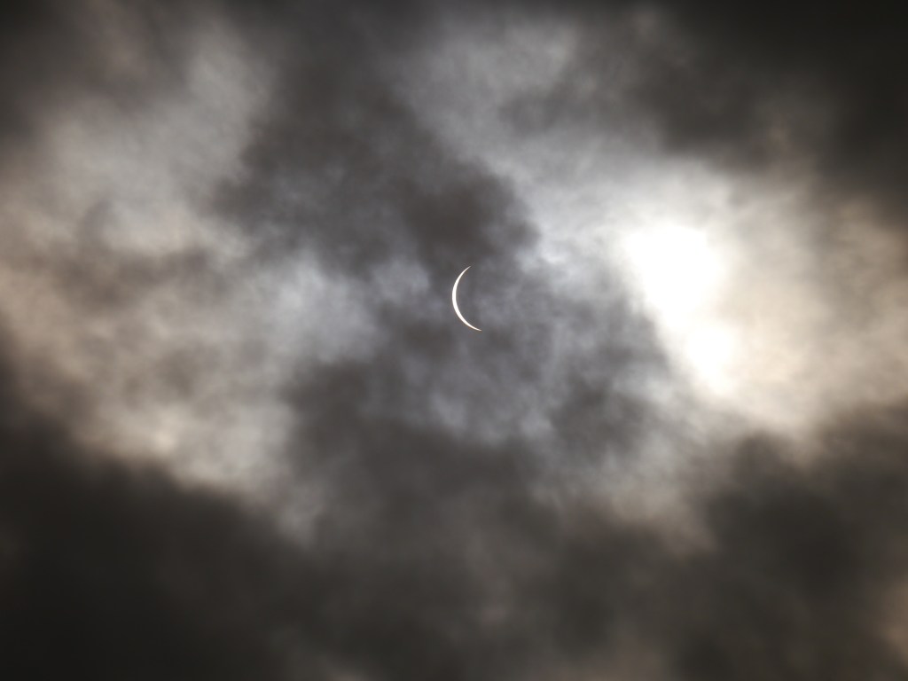
The highest recorded wind speed of 46 mph on March 16. However, a possible microburst on that date damaged the wind sensors and the mast they were mounted on. Wind data was unavailable for 5 days until the mast was repaired and the sensors were replaced. It is possible that the wind speed was higher. See the blog post.
On Sunday, March 16, 2025, at 2:30 PM, a line of severe thunderstorms passed through our area. A high wind of 46 mph ripped out the guy lines of my weather mast and bent it over by 45 degrees. The State College NWS Office (CTP) reported microbursts in the area so it is possible that the wind speeds were higher. More information about the storm: https://www.weather.gov/ctp/2025-Feb-15to17-Mixed-Precip-High-Winds
Damaged MastHigh Wind Speed Before Instrument Failure
I removed the damaged 16 gauge 10’ mast section (pictured below).
I installed two new 5′ mast sections and a new wind sensor package. The wind direction sensor had been behaving erroneously several weeks before the storm. The mast was hoisted into place and secured to the fence post with new hose clamps. The wind sensor cable was plugged into the weather station transmitter and secured with cable ties. The guy lines were then staked to the ground.
February was 0.3 deg F above normal for temperature. The high for the month was 53.8 deg. F, recorded on February 4. The low for the month was 7.9 deg F, recorded on February 19. There were 10 days when the maximum was at or below 32 F and 24 days when the minimum temperature was at or below 32 F. There were 998 heating degree days and 0 cooling degree days.
February was an above-normal month for precipitation with 1.74 inches of rainfall recorded, which was 0.42 inches above normal. The maximum rainfall in a single day was 0.81 inches recorded on February 16. There were 12 days of rain >.01 in, 7 >.10 in, and 0 > 1 in.
There were 5.4 inches of snow for the month, with a maximum daily total of 1.6 inches on February 16.
January was 3.5 deg F below normal for temperature. The high for the month was 44.8 deg. F, recorded on January 31. The low for the month was -8.7 deg F, recorded on January 22. There were 17 days when the maximum was at or below 32 F, 31 days when the minimum temperature was at or below 32 F, and 3 days when the minimum temperature was at or below 0 F. There were 1274 heating degree days and 0 cooling degree days.
January was a below-normal month for precipitation with 1.46 inches of liquid precipitation recorded, which was 1.46 inches below normal. The maximum liquid precipitation in a single day was 0.47 inches recorded on January 31. There were 11 days of rain >.01 in, 4 >.10 in, and 0 > 1 in.
There were 9.3 inches of snow for the month, with a maximum daily total of 2.4 inches on January 4.
Amateur radio operators (also known as hams) are ready to provide valuable communications when all other conventional methods fail. Many amateurs have joined the National Traffic System (NTS) network, and spend their free time relaying messages, called Radiograms, completely free of charge.
You can send a message of 25 words or less, as long as it’s not business-related, urgent, or private. The NTS is an open system. Your message will be picked up by an amateur radio operator and then relayed by voice, digital modes, or even by Morse code. Finally, the recipient will get a phone call from a local ham, or the message might be delivered by mail, or in person.
Overall, the year’s temperatures were above normal. The annual mean of 52.8 F was 2.6 F above normal. The annual precipitation of 43.74 inches was 2.21 inches above normal.
2024 Weather Data
January
January was the coldest month of 2024 but was warmer than normal with a monthly mean of 31.3 F, which was 4.1 F above normal, with a high of 62.6 F and a low for the month of 4.8 F. Precipitation was 1.93 inches above normal with 4.85 inches of liquid precipitation. There were 8.3 inches of snow for the month, with a maximum daily total of 5.5 inches on January 7.
High wind speed for the month and year was 47 mph on January 14.
February
February was an above-normal month for temperature, with a mean of 36.1 F, which was 7.0 F above normal. The high was 61.4 F and the low was 4.8 F. Precipitation was 0.72 inches below normal at 1.74 inches. There were 6.3 inches of snow for the month, with a maximum daily total of 4.0 inches on February 17.
High wind speed of 39 mph on February 28.
March
March temperatures were 7 F above normal with a mean of 44 F. The high was 74.2 F and the low was 18.5 F. Precipitation was 0.02 inches below normal with 3.36 inches of liquid precipitation. There was no measurable snow accumulation.
High wind speed of 45 mph on March 11.
April
Temperatures were 2.9 F above normal in April with a mean temperature of 63.0 F. The high was 84 F and the low was 28.0 F. Rainfall was 2.41 inches above normal at 5.92 inches. The last day of temperatures below freezing was April 22.
The high wind speed for the month was 38 mph.
May
Temperatures were 2.6 F above normal with a mean temperature of 62.4 F. The high was 85.4 F and the low of 40.1 F. Precipitation was 5.40 inches, 1.76 inches above normal.
The high wind speed was 34 mph.
June
Temperatures for the month were 1.9 F above normal with a mean of 70 F. The high for the month was 93.6 F and the low was 43.9 F. Precipitation was 1.64 inches below normal with 2.45 inches of rainfall.
The high wind speed was 27 mph.
July
July was the warmest month and temperatures were 1.9 F above normal with a mean of 74 F. The high for the month was 94.7 F and the low was 49.5 F. Rainfall was 1.49 inches below normal with 2.30 inches of precipitation.
The high wind speed was 29 mph.
August
August temperatures were 0.7 F below normal with a mean of 69.7 F. The high was 92.9 F and the low was 45.4 F. Precipitation was 5.20 inches above normal at 9.36 inches. August was the rainiest month of 2024.
The high wind speed was 28 mph.
September
Temperatures were normal with a mean of 63.5 F. The high was 83.9 F and the low was 42.4 F. There were 1.94 inches of rainfall, which was 2.01 inches below normal.
High wind speed was 25 mph.
October
October was mild with temperatures at 1.4 F above normal with a mean of 53.3 F. The high was 80.4 F and the low was 29.7 F. The first freeze was on October 15. Rainfall was 0.95 inches, which was 2.51 inches below normal.
The high wind speed was 25 mph.
November
Temperatures in November were mild at 3.1 F above normal with a mean of 44.3 F. The high was 72.2 F and the low was 20.9 F. Precipitation was 2.55 inches, 0.44 inches below normal. The first snowfall of the season was on November 22.
The high wind speed was 30 mph.
December
December temperatures were near normal, with a mean temperature of 32.2 F. The high for the month was 61.8 F deg. F, and the low was 4.1 F. Precipitation with 2.92 inches of liquid precipitation recorded, which was 0.26 inches below normal. There were 2 inches of snowfall.
December was near normal for temperature. The high for the month was 61.8 deg. F, recorded on December 29. The low for the month was 4.1 deg F, recorded on December 23. There were 26 days when the minimum temperature was at or below 32 F, 9 days when the maximum temperature was at or below 32 F, and 0 days when the minimum temperature was below 0. There were 1017 heating degree days and 0 cooling degree days.
December was a below-normal month for precipitation with 2.92 inches of liquid precipitation recorded, which was 0.26 inches below normal. The maximum rainfall in a single day was 0.72 inches recorded on December 9. There were 13 days of rain >.01 in, 7 >.10 in and 0 > 1 in.
The 2024 season ended yesterday. There were 18 named storms, 11 hurricanes, and 5 major hurricanes (>= 3 on the Saffir-Simpson Scale).
Michael Mann hilariously predicted 33 named storms.
2024 Atlantic Hurricane Summary Table
Name Dates Max Wind (mph)
TS Alberto 19-20 Jun 50 MH Beryl 28 Jun-9 Jul 165 TS Chris 30 Jun-1 Jul 45 H Debby 3-9 Aug 80 H Ernesto 12-20 Aug 100 H Francine 9-12 Sep 100 TS Gordon 11-17 Sep 45 MH Helene 24-27 Sep 140 H Isaac 26-30 Sep 105 TS Joyce 27 Sep-1 Oct 50 MH Kirk 29 Sep-7 Oct 145 H Leslie 2-12 Oct 105 MH Milton 5-10 Oct 180 TS Nadine 19-20 Oct 60 H Oscar 19-22 Oct 85 TS Patty 2-4 NOV 65 MH Rafael 4-10 Nov 120 TS Sara 14-18 Nov 50